-40%
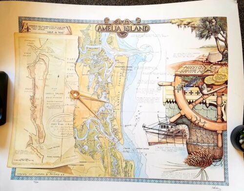
MAP NAUTICAL SEA CHART Limited Addition Signed Print Amelia Island
$ 25.87
- Description
- Size Guide
Description
DESCRIPTION: Signed and numbered decorative limited-edition nautical print of the coast nearAmelia Island, Florida
. This fine modern print features a 20th-century Coast Survey chart of the Atlantic Coast in that area overlaid with a eighteenth-century "Plan of Amelia Island in East Florida" by Fuller/Jefferys. With images of shrimp boats, nets and other artifacts that evoke the laid-back low-country charm of that area.
Signed in pencil and dated within to 1987. Number 46/500.
A fine original gift for those with interests in boating, fishing, or beach recreation in the area near Amelia Island or the Florida Altantic Coast
A few corners tacked but will be beautiful framed. All offers considered. Delivered rolled.
